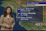
this ridge is extending all the way that canada. this is what is going to continue our warming for saturday. there is a little fly in the ointment. on sunday a strong trough is developing in the gulf of gulf of alaska that will weaken the ridge enough that our warming trend pauses on sunday. inland area about the same. beaches actually see temperatures drop a few degrees. but not for long. going back up again on monday and it is really going to get toasty around the entire area heading into monday with possible records. numbers tonight on the mild side. mainly 50's you will see upper 50's around concord, concord, antioch, sant san jos jose, palo alto, san mateo oshtion san francisco and upper 50's. low 50's around the north bay valley. it is a spare the air day for your saturday. poor air quality in the santa clara valley. moderate air quality in the inland east bay and good for the rest of the bay area. with weak sea breeze and late in the day temperatures are going to come up some more tomorrow. warm day in the south bay with 91 i
 Live Music Archive
 Librivox Free Audio
 Metropolitan Museum
 Cleveland Museum of Art
 Internet Arcade
 Console Living Room
 Books to Borrow
 Open Library
 TV News
 Understanding 9/11